Tracking via Satellite - The SHARC Tagging Initiative
In the realm of marine conservation, satellite tagging has emerged as a valuable tool for scientists to gather data on various marine species, including sharks. However, this technology presents challenges for engineers like Peter de Maagt, an antenna specialist at the European Space Agency (ESA).
One of the key challenges is durability and reliability. Tags must withstand the harsh marine environment, pressure, and biofouling while maintaining connectivity. Antenna design is another crucial aspect, with the need for miniaturized, energy-efficient antennas that ensure consistent data transmission via satellites, often underwater or near the surface. Power constraints are also a significant factor, as tags need to operate for extended periods with limited energy, balancing data transmission frequency and battery life. Data retrieval is another challenge, ensuring data is transmitted to satellites despite the movement and varying depths of marine species.
Innovative solutions often involve advances in antenna technology, improved battery systems, and integration with satellite constellations to enhance coverage. For instance, ESA's SHARC tags boast key properties such as smaller and lower weight, longer battery life, increased memory, and bi-directional communication with the satellite.
Beyond marine species research, satellite tags are being repurposed for innovative projects combating marine litter. These initiatives leverage tracked marine animals as natural sensors, analysing their movement and interactions with debris to better understand litter distribution and hotspots. Some projects combine satellite telemetry data with environmental monitoring to identify and predict marine litter accumulation, informing cleanup and prevention efforts.
Peter de Maagt, an accomplished underwater photographer and antenna specialist for the ESA, has been at the forefront of these developments. He shared insights into these projects during a presentation to the Bristol Underwater Photography Group and during a field expedition in the Dutch Antilles, where he worked alongside scientists.
One of the challenges Peter addressed was the issue of tags attempting to send data when no satellite was immediately reachable, which drains the batteries too quickly. ESA has provided a solution by having the tags only send brief 'are you there?' messages until an acknowledgment from the satellite is received, and only then is all the data transmitted to mission control.
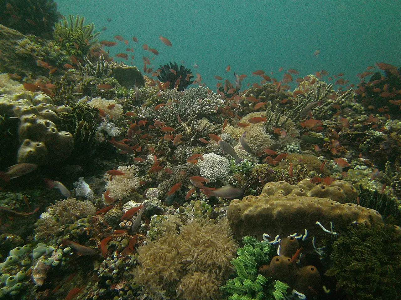
The ESA is sensitive to environmental issues, particularly marine conservation. The strategy is to detect the sources of marine litter and the pathways they take to get into the oceans, and to predict where litter might end up to help reduce or control it. The protected area near Saba in the Dutch Antilles, as shown in the map, is a prime example of this, providing a sanctuary where sharks thrive.
ESA's tags incorporate a glass cannister that will break at a set pressure, cutting the link to the animal and allowing the tag to surface as a safety feature. The computer chips used in the tags are now readily available from a Belgium-based company. Peter de Maagt shared an image of data from a tag that was deployed and returned to the surface in the Gulf of Mexico.
In conclusion, satellite tagging is a valuable tool in marine research and conservation, with Peter de Maagt playing a significant role in addressing the challenges and driving innovative solutions. The ESA's initiatives in this area, including combating marine litter, demonstrate a commitment to environmental stewardship. For more precise and updated information, consulting ESA publications or Peter de Maagt’s presentations would be recommended.
- Peter de Maagt, an antenna specialist at the European Space Agency (ESA), discussed innovative solutions to satellite tagging challenges during a presentation to the Bristol Underwater Photography Group.
- Scientists use satellite tagging to gather data on various marine species, such as sharks, to study their behavior and help with marine conservation efforts.
- One of the challenges in satellite tagging is that tags must withstand harsh underwater conditions while maintaining connectivity and durability.
- The ESA's SHARC tags have key advancements, such as smaller weight, longer battery life, increased memory, and bi-directional communication with the satellite.
- Beyond marine species research, satellite tags are being repurposed for projects that combat marine litter, using the movement and interactions of marine animals with debris to analyze litter distribution and hotspots.
- The protected area near Saba in the Dutch Antilles is an example of an environment where marine conservation efforts are being made to protect sharks and reduce marine litter.


